
Construction
large scale infrastructure, residential buildings and commercial developments
With huge investments and strict timelines any delays will lead to costly delays and safety risks.
Drone derived data empowers informed decisions and increases efficiency.
Use Cases of Drones in Construction
Aerial Surveys & Mapping:
Todays Drones are equipped with advanced sensors which allow the capture of high resolution aerial imagery and data, this data is used to create incredibly accurate site surveys allowing teams to respond immediately to any emerging issues thus preventing delays and maintaining project timelines.
Progress Monitoring:
Comparing 2D maps and 3D models to design specifications allows construction managers to ensure every aspect of the project aligns and therefore identify any discrepancies as they happen allowing real time action to be taken preventing minor issues from becoming costly delays.
3D modelling & BIM integration:
Drone data such as 3D mesh models and point clouds can be integrated into Building Information Models (BIM) taking project visualisation, planning and decision making to the next level.
Marketing:
The stunning aerial footage captured enhances marketing materials, aids presentations and gives a dynamic view of the project.
‘Drone surveying has become a crucial tool within the construction industry, allowing your teams to take complete control of your sites throughout the life of the project’
Call us for a chat and see how utilising drone data will benefit your project.
For more information regarding our competitive rates, see our pricing page. and contact us to chat about how we can help you.
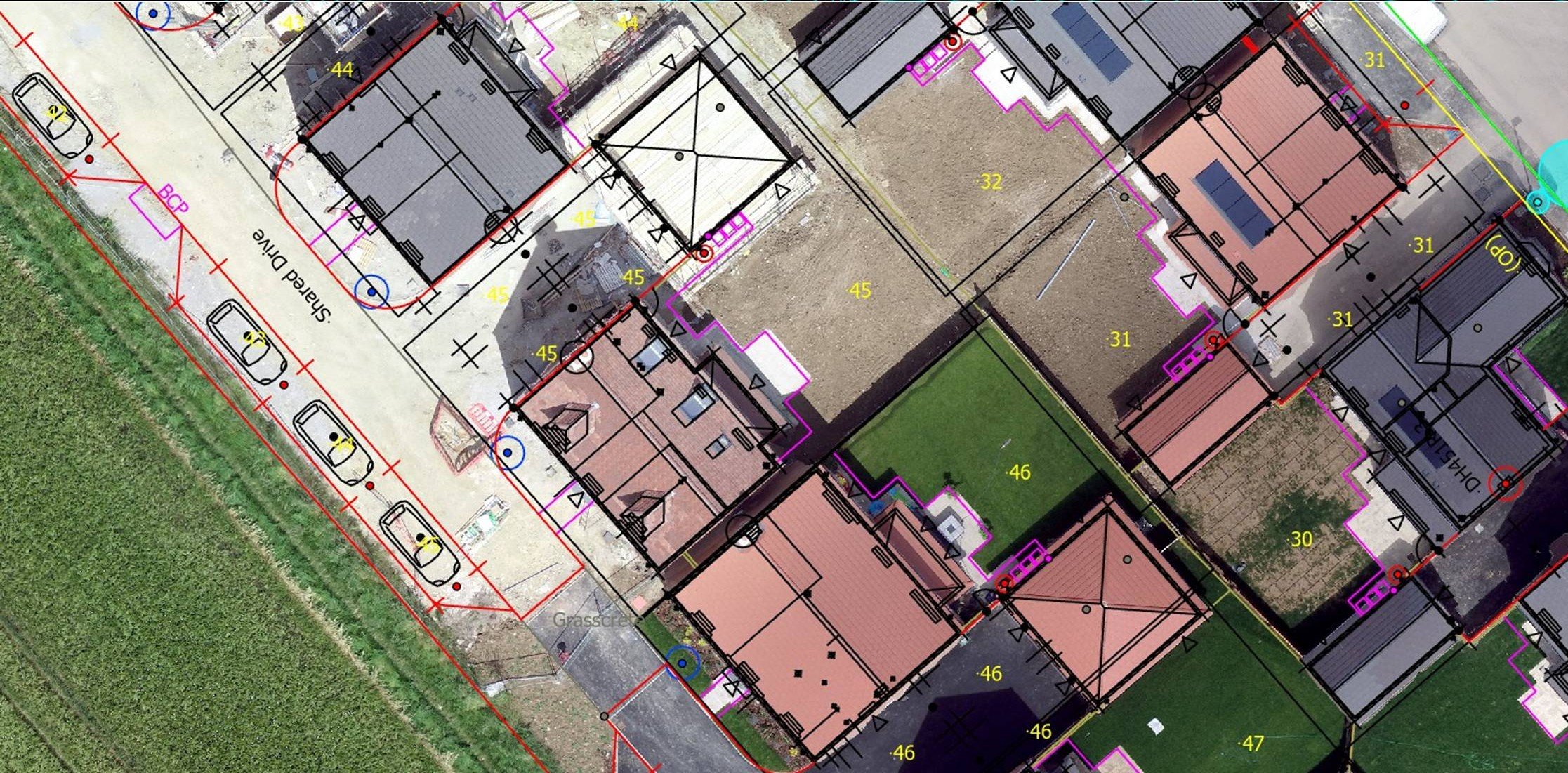
2D Orthomosaic Map overlay - highlighting potential discrepancies.

Full site 2D Orthomosaic Map - Progress Monitoring